
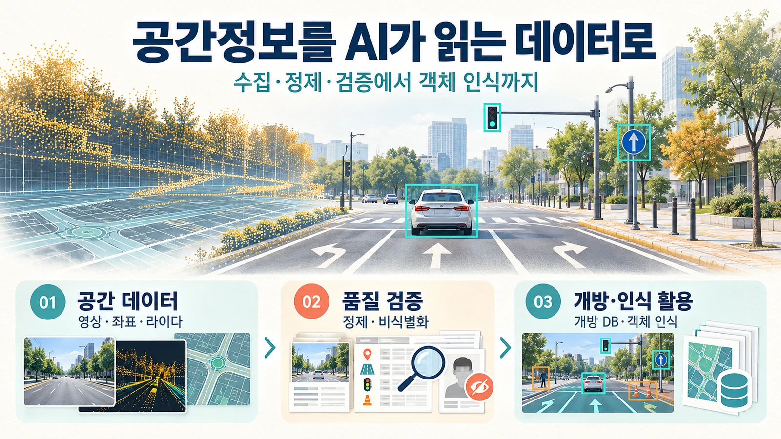
To connect spatial information open data and recognition models, source images, coordinates, and lidar data must be structured and quality reviewed using the same standards. This article introduces the application structure leading to data collection and purification, open database design, and road object recognition.
How do we use the data we collect?
| step | main task | Deliverables to review |
|---|---|---|
| Spatial data cleaning | Summary of acquisition conditions and connection standards for images, coordinates, and lidar | Data lists and metadata |
| Purification/De-identification | Check for coordinate/format errors and whether personal information is included | Purification rules and processing records |
| Open DB design | Define schema, format, usage conditions and labels | Structured data and quality review materials |
| Recognition Model Utilization | Evaluate detection and classification of objects such as lanes, signs, and signals | Recognition results and evaluation records by type |
What quality standards are needed?
- Check data rights and scope of disclosure and learning use.
- Check the shooting conditions, coordinate system, metadata, and image connection.
- We review whether to process de-identified objects such as license plates and faces.
- Label location/classification and omissions/errors are evaluated based on established standards.
- The model reviews the evaluation data together with false positives, false positives, and measurement indicators by type.
Formats such as COCO·GeoJSON and indicators such as IoU·mAP·F1 can be selected depending on the purpose of application. This page does not present specific achievement values or inspection passing rates as confirmed achievements.
How are the roles of GLT and partners divided?
| area | Role in collaboration |
|---|---|
| GLT Korea | Spatial information/image linkage schema, data collection/purification requirements, metadata and label quality review system |
| AI technology partners | Design and implementation of AI model, agent, and platform, and model evaluation and operation technology |
| Customer company/operating organization | Data use rights, business review, application approval and operating policy |
The table above divides the areas of collaboration, and the actual scope of performance and output for each project is confirmed according to the contract and division of work.
Explanatory experience flow
You can envision a flow that looks at source data and coordinates, checks quality review items, and then compares object recognition results. The infographics and step descriptions in the text do not represent actual operating screens or real-time model execution results.
Disclosure and scope of explanation
Introduction to Serendex Public ProjectIntroduces a national spatial information agency's open DB/machine learning recognition model and an example of establishing a foundation for utilizing autonomous driving data.
This article explains the application structure based on the published examples and the domain perspective of GLT. Each customer's contract period, inspection results, and quantitative performance are provided separately from the technical description on this page.